Research

My research focuses on the structure and tectonics of convergent mountain belts. Of particular interest are convergent orogen dynamics, fold-thrust belt kinematics, and the feedbacks between subsurface deformation and surface processes. This work combines methods of field mapping, seismic interpretation, thermochronology, geomorphology and micropaleontology. By implementing diverse techniques I seek to obtain a holistic understanding of the structural deformation of a study area at varied temporal and spatial scales. Present research projects are based in Timor, the Southern Appalachians, and New Zealand. The results of these projects will help improve earthquake hazard mitigation, geodynamic understanding of plate tectonics, land use and conservation, and natural resource exploration.
Timor
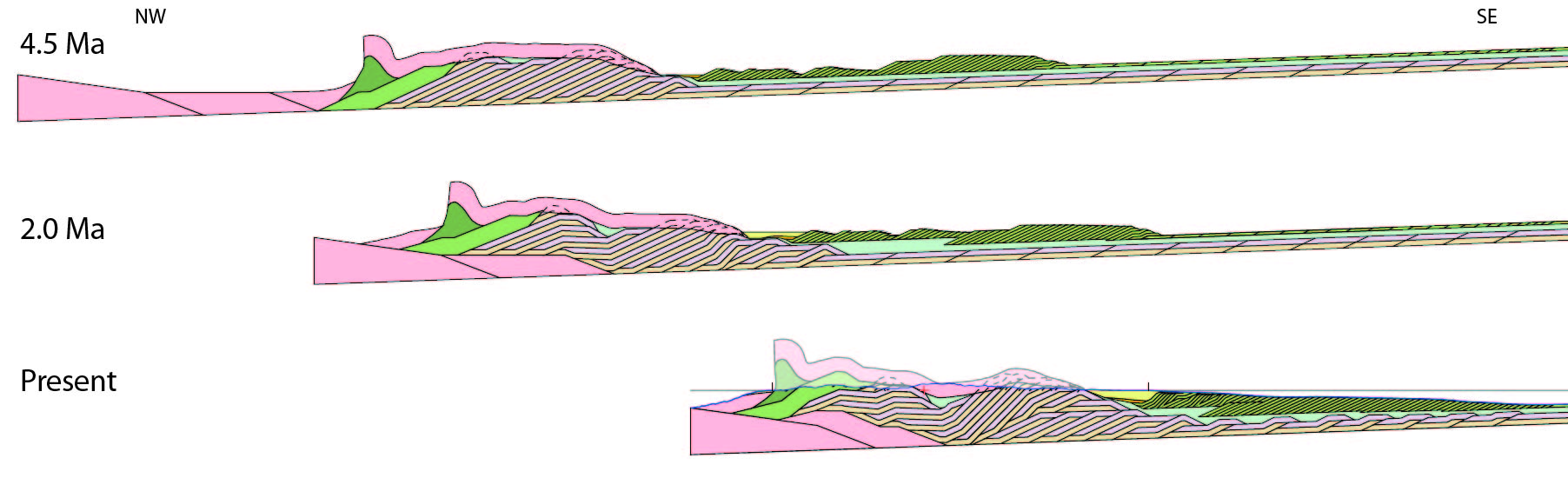
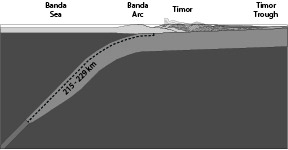
In Timor, my research examines the plate tectonic dynamics of of arc-continent accretion. Thermochronology and micropaleontology constrain the timing of several key stages of deformation, exhumation, and uplift (Tate et al., 2014; Tate et al., 2017). Field mapping and balanced cross sections, combined with the above ages, have revealed the geometry of deformation and magnitude of shortening (Tate et al., 2015; Tate et al., 2017). Shortening estimates on Timor demonstrate that over 200 km of continental subduction has occurred during the arc-continent accretion process at Timor, challenging canonical representations of this key step in the Wilson Cycle and providing an important new constraint to geodynamic models (Tate et al., 2015; Tate et al., 2017). Furthermore, structural, thermochronologic, and geomorphologic analyses all point toward active thrust fault deformation within the Timor orogen, and highlight several onshore and nearshore zones of seismic hazards (Tate et al., 2014; Tate et al., 2017; Tate et al. in prep).
Sequential Structural Deformation of Timor-Leste (Tate et al. 2015)
Schematic of Continental Subduction at Timor (Tate et al. 2015)
Southern Appalachians
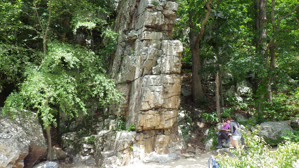
Research in northeast Tennessee examines the geometry and kinematic development of duplexes within the Mountain City Window. New 1:24,000-scale geologic mapping (Sharp et al., 2017; Richardson et al., 2018) has provided significantly improved constraints on fault locations, fault branching patterns, and structural geometries compared to existing regional-scale mapping. This new structural data allows for improved understanding of the faulting and folding mechanisms of foreland-dipping duplexes, allowing us to better predict structural geometries both in the Appalachians and in orogens worldwide. Additionally, new geologic mapping shared in collaboration with the USGS, TN Geological Survey, and Cherokee National Forest will improve land use, conservation, and resource management in both public and private lands.
New Zealand
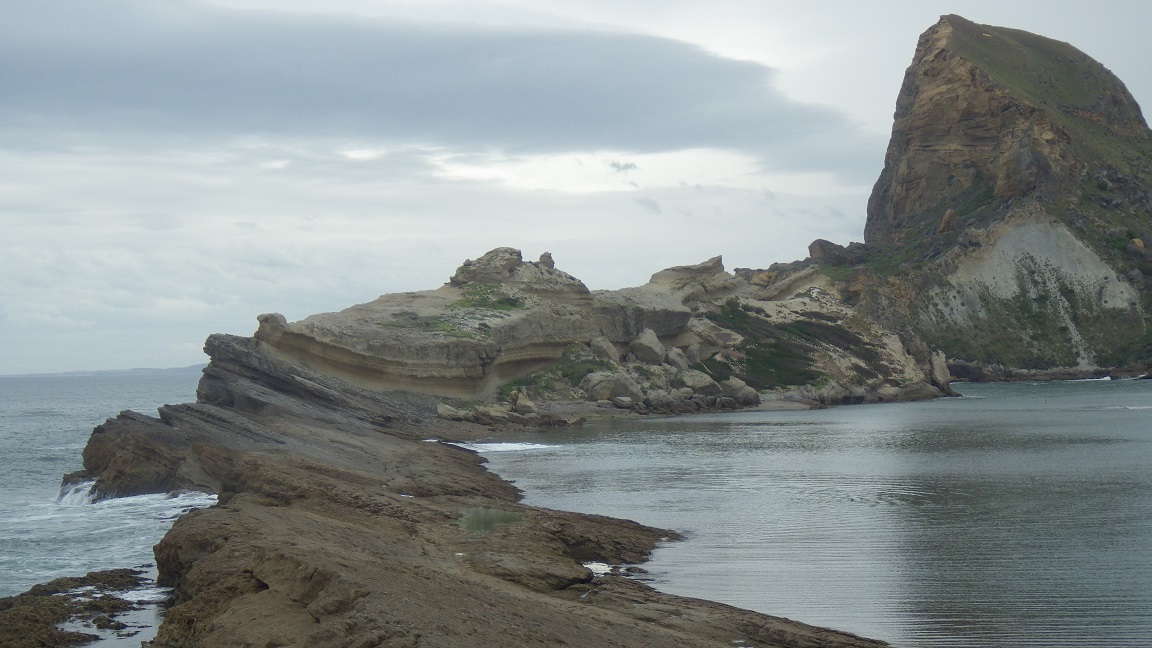
Seismic reflection data in the central Hikurangi Margin offshore northeast New Zealand reveal the dynamics of accretionary prism development. Present research focuses on structures within wedge-top basins in the nearshore region of the accretionary wedge. Seismic mapping of structure and stratigraphy linked with structural kinematic restorations reveal a multi-phase history that includes diagnostic growth strata geometries, erosional unconformities, extension, and inverted normal faults (Tate, 2018). These data reveal drastic shifts in deformation patterns through time. Such shifts allow us to examine critical taper dynamics, in particular the relative contributions that sedimentation at the top of the wedge and duplexing at the subduction interface have on the structural development of the wedge interior. Research also aims to link offshore seismic with onshore mapping in integrated structural restorations to examine the simultaneous effects of erosion and deposition on critically tapered wedges. Furthermore, new constraints on fault deformation styles at the sudbuction interface are directly applicable to seismic hazard modeling of the Hikurangi subduction zone.
Connect with Vanderbilt
©2026 Vanderbilt University ·
Site Development: University Web Communications