GIS and Spatial Analysis
My research utilizes GIS and spatial analysis to model human-scale perception and mobility in order to understand how dynamic human-landscape interaction shape social, political and economic interaction at multiple scales. I am particularly interested in the potential of spatial analysis as a platform for hypothesis generation and testing.
Mobile GIS Survey

Mobile GIS survey
My dissertation fieldwork (2012-2013) utilized a custom mobile GIS framework for architectural mapping, collection of architectural data and recording systematic surface collection areas. Using this methodology, my field crew and I were able to rapidly create complete digital architectural maps of each site in the field, eliminating the need for hand-drawn maps that would later need to be digitized.
Architectural data on defensive walls and structures were recorded on a digital form within the integrated GIS database. Additionally, for sites where we conducted systematic surface collections, collection points were recorded directly in the GIS database.
For this survey, I used a Motion J-series Windows tablet with ESRI ArcPad. GPS data was collected with a Trible GPS which connected to the tablet via Bluetooth.
Mobility modeling
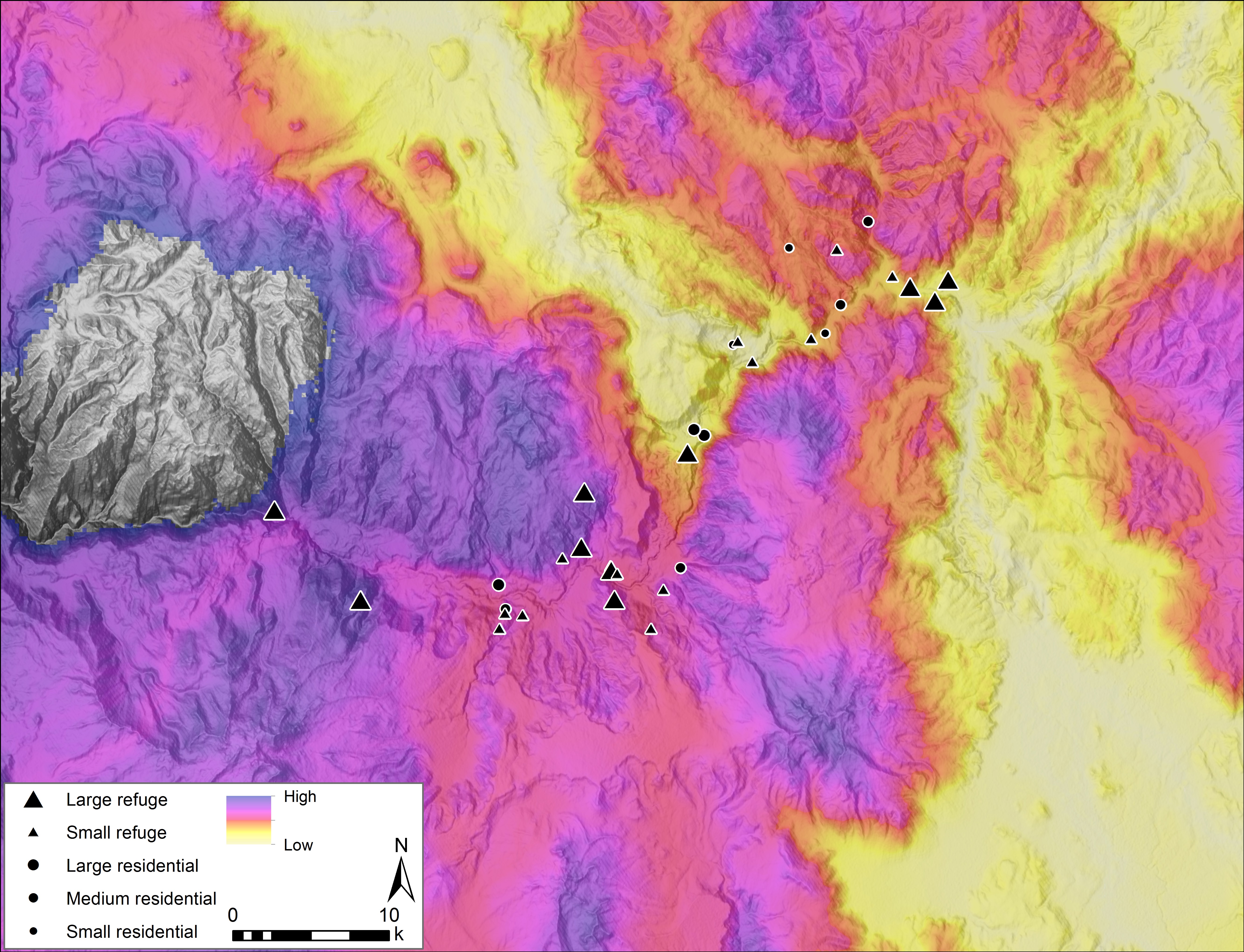
Mobility modeling using Circuit analysis and least-cost paths
I am currently exploring various methods for modeling mobility at a regional scale, primarily through two complementary methods–least-cost path analysis and circuit analysis. My current research has examined the relationship between fortification location and areas of “high accessibility,” to assess concerns over monitoring access routes to the valley. Both analyses provide the ability to examine the impact of local topography on human mobility.
©2024 Vanderbilt University ·
Site Development: University Web Communications