Home » News » Ancient Maya Agriculture at Tamarindito, Guatemala
Ancient Maya Agriculture at Tamarindito, Guatemala
Posted by anderc8 on Tuesday, November 15, 2016 in News, Research Scholar Grants.
Using Research Scholar Grant funding, Anthropology professor Markus Eberl studied economic wealth and sociopolitical power codevelop over time at the ancient Maya capital of Tamarindito. Ancient Maya subsistence rested on maize, beans and squash that were raised in a mixture of extensive and intensive techniques. Focusing on terraces, Prof. Eberl initiated an archaeological project at the site in 2009 with a systematic survey, partial mapping and test pit excavations in four field seasons. Maize was the major food source for Classic Maya and he used carbon isotope analysis to test whether the terraces were used for ancient maize agriculture. Below you will find a blog post and photos from his experience.

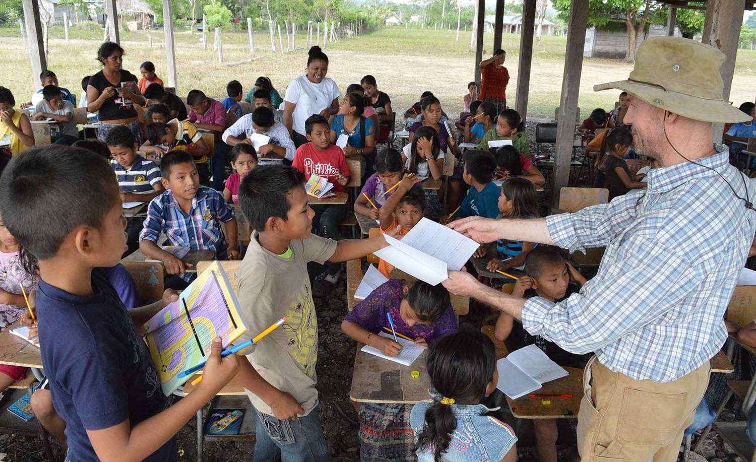
During the summer of 2016, Prof. Eberl spoke with local school children about the ruins of Tamarindito and explained their significance. Later that day, he gave them a tour of the site.
I work as an archaeologist in Central America. Since 2009 I have directed the excavations at the ancient Maya capital of Tamarindito in the tropical lowlands of Guatemala. The site dates mostly to the first millennium C.E. Its divine rulers and their royal court are contemporaneous with King Arthur and the Knights of the Round Table – but unlike the latter, Maya lords are historically attested through numerous hieroglyphic inscriptions. Tamarindito was abandoned hundreds of years ago and rain forest overgrew it since then. Now it is part of a national reserve and nominally protected by the Guatemalan government. I wish I could present myself as real-life Indiana Jones who dons a fedora and whip to conquer the wild. The reality is more sobering. In the last fifteen years, farmers have cut down the forest and converted at least three-quarters of the reserve into agricultural fields. I say at least because I have stopped measuring the rapidly advancing deforestation. In 2009, I started to use a GPS device to map newly cleared fields. However, only a few stands of trees remained in an otherwise denuded landscape by 2014. Forest still covers the center of Tamarindito with its pyramids and palaces – where my team and I stay in a tent camp – but agricultural fields surround it on all four sides. Wildlife – snakes, monkeys, birds, etc. – has largely disappeared together with the trees or was hunted to extinction.
The deforestation has two consequences for me. As an archaeologist I am interested in the ancient Maya but I cannot ignore the modern reality. This is why I give lectures and tours of Tamarindito to school children and local communities. I educate them about the cultural and natural treasures at their doorstep. Poverty is drastic in this part of Guatemala and I help where I can, for example by donating medicine to a local health center. My outreach has had some impact. Q’eqchi’ Maya elders promised me to celebrate a major ritual at Tamarindito next summer. This ritual will bring the entire community together and celebrate the ruins as a seat of ancestral spirits who guarantee plentiful harvests and the well-being of the community.

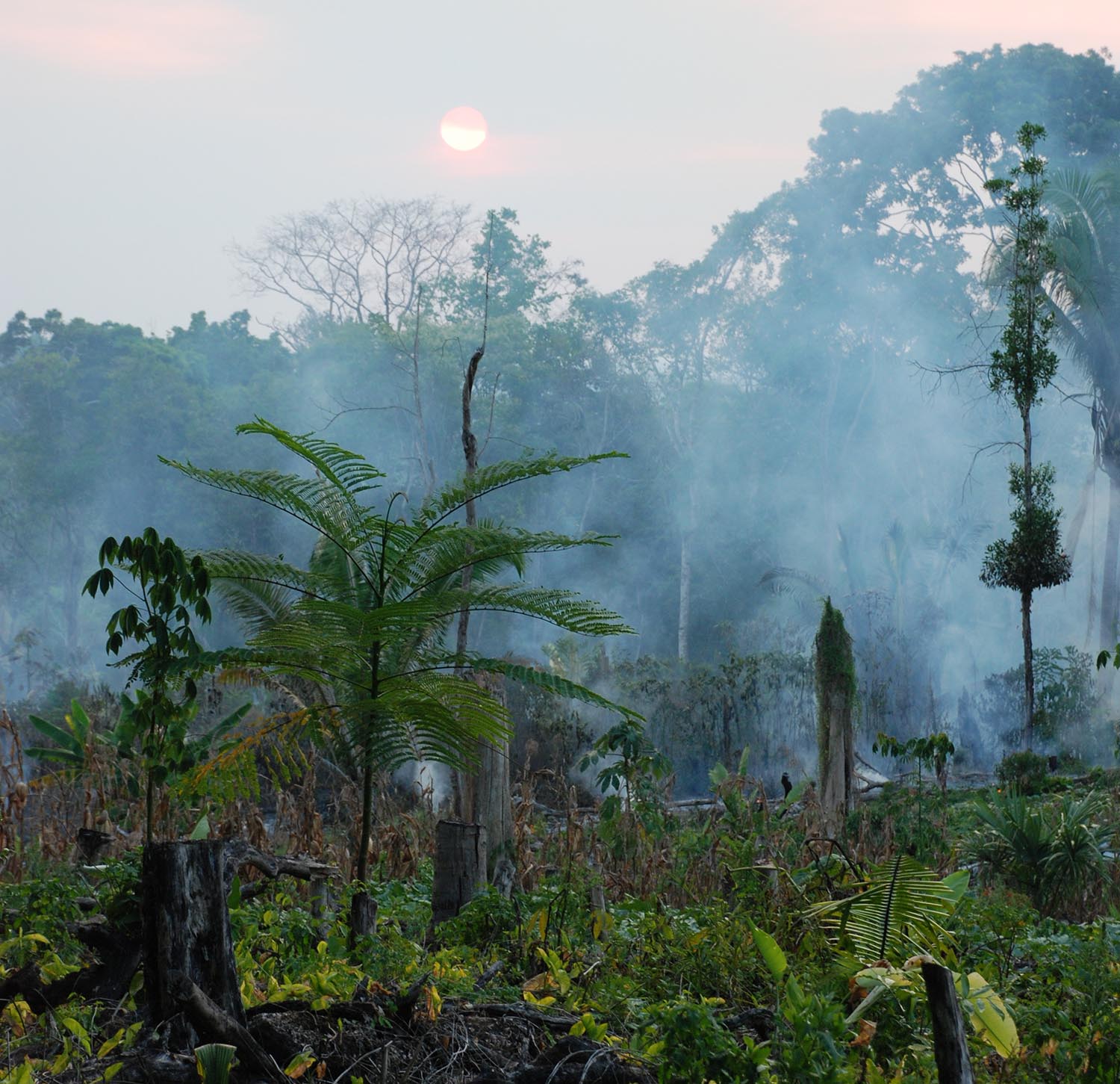
Sun setting over a burning field near the center of Tamarindito. A few days later, farmers planted squash there – illegally because this area is part of a national reserve.
Deforestation has also impacted the work that I do at Tamarindito. It has opened my eyes to the landscape and its resources that the ancient Maya were living in. Before working at Tamarindito, I excavated an ancient Maya village overgrown by the rain forest. Dense vegetation made it impossible for me to see more than ten or fifteen feet ahead and concealed entire buildings as well as a small pyramid. Tamarindito is very different. Because its forest cover is largely gone, I can perceive the layout of the site. Tamarindito is hilly with extensive depressions between hills. Its ancient inhabitants built their houses on hilltops fifteen hundred years ago to shield themselves from flooding and take advantage of breezes. People preserved their privacy and neighbors are often dozens of yards apart. Empty spaces abound between and below houses and I began to wonder how the ancient Maya used them.
Organic materials rot quickly in Tamarindito’s tropical environment. Many aspects of ancient Maya life have disappeared since Tamarindito’s abandonement in the tenth century C.E.: the wooden houses with palm-thatched roofs in which most people lived or the trees and plants that were growing in gardens and fields. In the last decades, soil scientists realized, though, that some plants leave chemical traces. My collaborator Richard Terry, a professor at Brigham Young University, employs carbon isotope analysis to reconstruct corn agriculture. Now a crop grown all over the world, corn was first domesticated in Mexico thousands of years ago and became a staple for the ancient Maya. Corn is a so-called C4-plant and its photosynthesis mechanism differs from C3-plants like wheat and rice. This results in a slightly higher ratio of carbon-13 to carbon-12, the two stable carbon isotopes. Corn was by far the most important C4-plant in ancient Maya times and required human intervention. If corn is grown for decades at the same spot, the soil will pick up its isotopic signature and conserve it for centuries. Carbon isotope analysis of soils helps me to reconstruct where the ancient Maya planted corn.
I have been working with Professor Terry for many years and we showed how the ancient Maya used depressions and wetlands for corn agriculture. This summer’s RSG grant allowed me to continue my previous work and add a new dimension. So far carbon isotope analysis has been used to detect the presence or absence of ancient cornfields. I began to wonder whether more tightly spaced samples could tell me how large their fields were. At stake is the idea of property. Alternative forms of property exist: People share their resources communally or states and other sociopolitical institutions hold property. The legal system of modern societies regulates and documents the different forms of property.

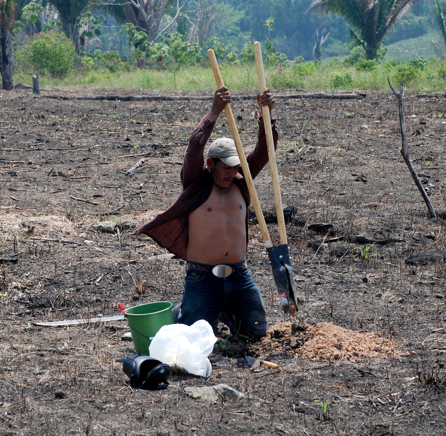
Ramiro Baqui Caal excavates a test pit with a posthole digger to take soil samples.
Surprisingly little is known about field sizes and property in ancient Maya society. Unlike written sources elsewhere, Maya hieroglyphic texts provide comparatively little insight. No legal code or constitution has survived. Archaeologists have excavated inscribed objects that identify their ancient owners. For example, the text on the famous ‘Hummingbird Vase’ from Tikal’s Burial 196 identifies it as a “drinking vessel” for Tikal king Yik’in Chan K’awiil. Many inscriptions contain similar ownership statements but have two shortcomings. Their owners are elites and therefore don’t reflect Maya society in its entire breadth. The statements refer overwhelmingly to portable objects like ceramic vessels or ornaments but not (at least not in a straightforward way) to land. The latter is a critical resource in an agricultural society and many scholars are keen to reconstruct how ancient Maya farmers – who accounted for at least nine out of ten people in ancient Maya society – owned and worked their land.
The question is whether land in ancient Maya society was private, communal, or public property. Comparisons show the variability. The Q’eqchi’ Maya who live near Tamarindito own their parcels of land while some Maya communities hold land communally (Mexico’s ejido system comes to mind). I expect that field sizes differ for different forms of property. Individually owned fields should be relatively small –between 3 and 10 acres judging from modern field sizes. Communally and publicly held lands should be much larger; for example, modern ejido lands exceed 250 acres each. Correspondingly, I selected an area of approximately 75 acres to take soil samples at Tamarindito. The entire area should evidence for ancient corn agriculture if it was held communally or as state property; otherwise, I’d expect to identify about seven to ten individual fields if the ancient Maya held land individually.
I take advantage of a perceived shortcoming of carbon isotope analysis. Short-term maize cultivation does not immediately affect soil chemistry. The previous studies of Richard Terry and me have shown that maize has to be cultivated for long periods of time – likely decades – in the same place before a strong carbon isotope signature develops. Many of our test pits were excavated in areas of modern maize cultivation. Interviews with the farmers showed that they started to move these areas only in the last fifteen to twenty years. Nonetheless, modern maize cultivation has not yet shifted the carbon isotope ratios. Surface soil samples from our test pits still show forest δ13C ratios. I employ this observation to ancient Maya agriculture. Highly negative carbon isotope signatures can only be expected in areas where maize was grown for generations. This implies that people used the same parcel of land over and over again and presumably also owned it and passed it down.

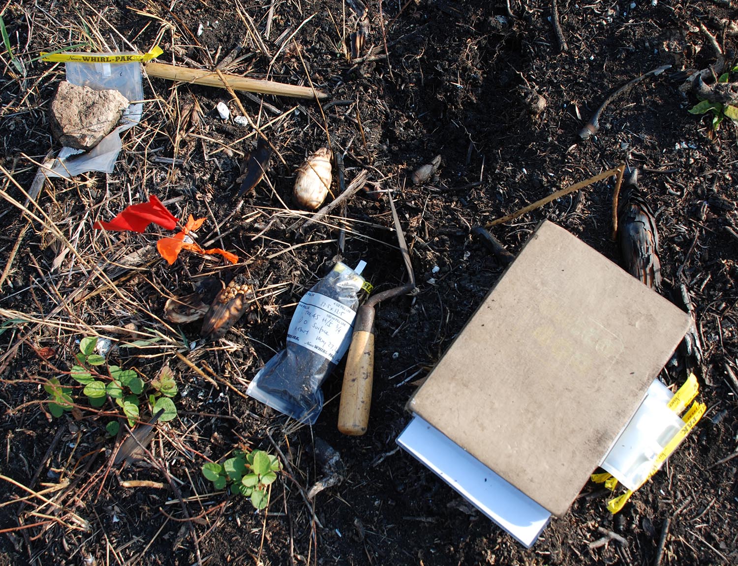
Soil sample for soil chemical analysis.
In May, I traveled to Tamarindito to take an extensive number of soil samples. My setup was simple. I brought a post-hole digger, soil samples bags, and a handheld GPS receiver. With the latter I set up a sampling grid over approximately 75 acres at the southern edge of Tamarindito. I selected a plain area with deep soils where modern Maya farmers have their fields. The ancient Maya residential groups in its vicinity all date to the Late Classic (the seventh through ninth centuries C.E.). My sampling area was likely in use during these centuries as well. I marked sampling points with small flags and hired Ramiro Baqui Caal, a local Q’eqchi’ Maya, to help me take four soil samples at each point. One sample comes from the modern surface, the second about 5 inches down, the third about 10 inches down, and the fourth about 20 inches down. In previous excavations, I established that the Late Classic surface is between 5 and 10 inches below the modern surface (soils built up on top of it since the abandonment of Tamarindito in the tenth century C.E.). If the Late Classic Maya planted corn at a given spot for a prolonged period of time, the carbon isotope ratios in the second or third soil sample should show a corresponding shift. On the other hand, the first and fourth soil sample should exhibit the normal carbon isotope ratios. The four carbon isotope ratios from each test pit can be plotted vertically. The diagram should show a central spike if ancient corn agriculture was practiced there. With the help of Ramiro, I took 249 soil samples from 64 test pits.
I brought the soil samples to my laboratory in the city of Flores, Guatemala. There I hired several local students to dry and pulverize the soil samples. Just before returning to Nashville at the end of June, I shipped the soil samples to Richard Terry’s laboratory at BYU. The laboratory staff is now analyzing them and I hope to receive the results by the end of the year. I’ll then plot the results both vertically (for each test pit) as well as horizontally (across the 75 acres) to see where the ancient inhabitants of Tamarindito practiced corn agriculture and how large their ancient fields were.
